The Stocks and The Moat
SE 24 NE NORTH RIGTON MAIN STREET (south side)
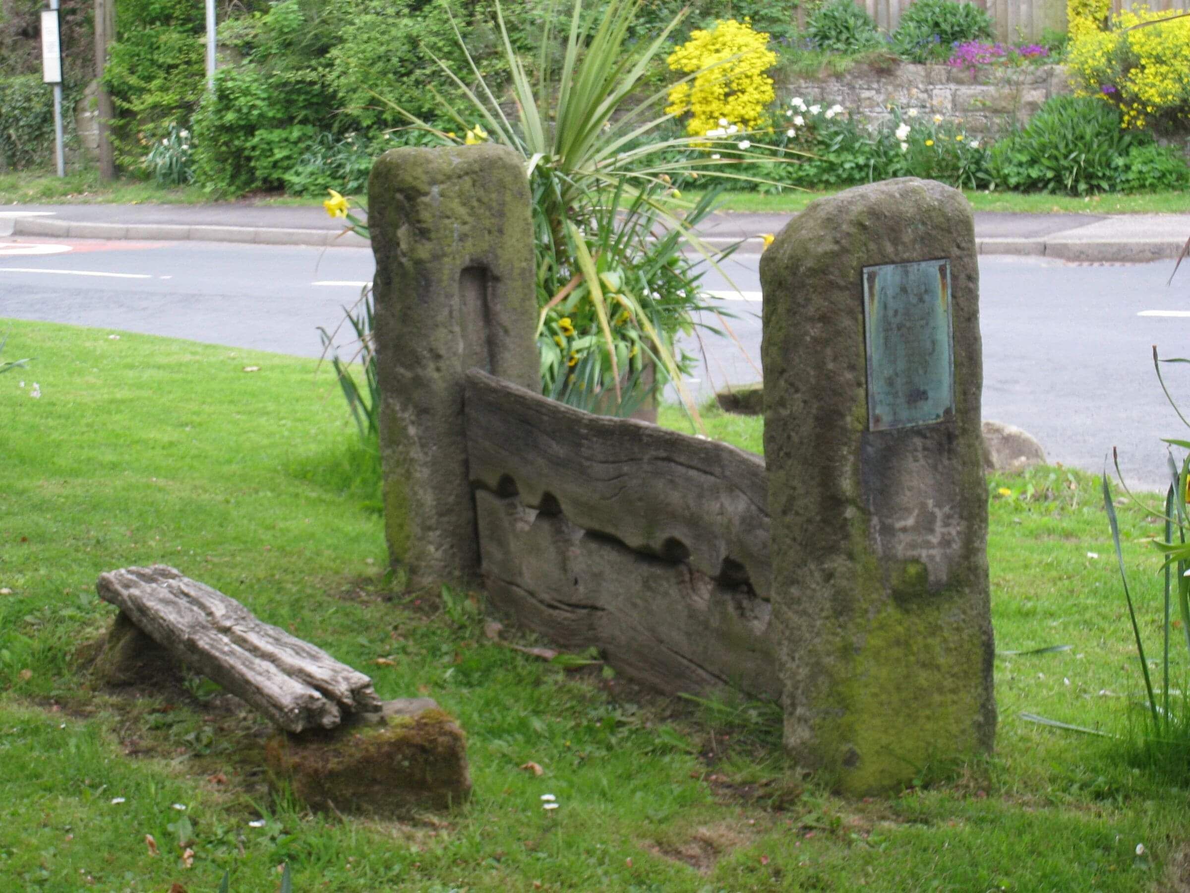
- Pair of double stocks. Possibly C17, restored 1930 and 1960.
- Gritstone and wood.
- Pair of stone posts approximately 1 metre high, grooved on inside faces.
- 2 wooden boards slotted between, with holes for 2 pairs of legs.
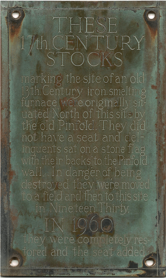
- A brass plaque on one post records that the stocks now stand on the site of the old smithy.
- They were removed from the old pinfold in 1930 and restored at that time and again in 1960.
The Stocks


The picture shows a close up of the brass plaque on one side of the village stocks.
Listing NGR: SE2804849265
Source: English Heritage
Listed building text is © Crown Copyright. Reproduced under licence.
The Moat
Around 6,000 moated sites are known in England. They consist of wide ditches, often or seasonally water-filled, partly or completely enclosing one or more islands of dry ground on which stood domestic or religious buildings. In some cases the islands were used for horticulture. The majority of moated sites served as prestigious aristocratic and seigneurial residences with the provision of a moat intended as a status symbol rather than a practical military defence. The peak period during which moated sites were built was between about 1250 and 1350 and by far the greatest concentration lies in central and eastern parts of England. However, moated sites were built throughout the medieval period, are widely scattered throughout England and exhibit a high level of diversity in their forms and sizes. They form a significant class of medieval monument and are important for the understanding of the distribution of wealth and status in the countryside. Many examples provide conditions favourable to the survival of organic remains.
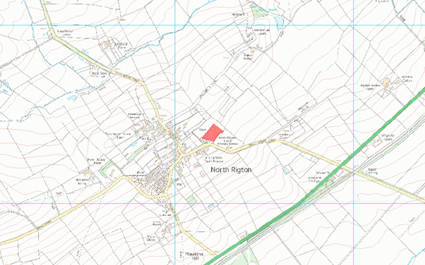
MAP EXTRACT
The site of the monument is shown on the attached map extract. It includes a 0 metre boundary around the archaeological features, considered to be essential for the monument's support and preservation.

The moated site at North Rigton survives well and significant archaeological remains will be preserved within the platform and the accumulated silts of the ditches. The site offers important scope for the study of the economic and domestic arrangements of medieval moated sites and their role in the wider landscape.
Details
The monument includes a moated site visible as a rectangular platform and surrounding ditch. It lies on a gentle slope to the north east of the village of North Rigton. The moat ditch is steep sided and varies in depth from about 2.5m on the north side to 1.75m on the south side and is up to 15m wide. It encloses a central, level platform measuring 40m north east-south west by 28m north west-south east.
There are traces of earthworks on the north east part of the platform and a slight outer bank on the south east side of the moat. There is no sign of a causeway for access to the platform and the location of any bridge is also unknown.
The monument is thought to be site of a manor house owned in the 13th century by the de Lethley family. From 1244 until the Dissolution of the Monasteries in 1539 the manor was held by Fountains Abbey. The wall extending along the south west edge of the moat is totally excluded from the scheduling.
